

Surviving the Moki Dugway in Our EarthRoamer: Utah's Most Dangerous Road?
Most people tackle the Moki Dugway in a Jeep. We did it in a 20,000-lb EarthRoamer — and Jacob has an intense fear of heights. Here's what happened.

The Road No One Thinks You Should Take
There's a sign at the base of the Moki Dugway that stops most RVers cold: "NOT RECOMMENDED for vehicles over 10,000 lbs." Our EarthRoamer LTS weighs double that. And yet, there we were.
If you've never heard of the Moki Dugway, it's a 3-mile unpaved switchback road carved into the edge of Cedar Mesa in southeastern Utah; 1,200 feet of elevation gain, an 11% grade, and one set of guardrails that exist more as a suggestion than a safety measure.
This post walks you through the full leg of our Southern Utah journey: Goosenecks State Park, Valley of the Gods, the Moki Dugway, Muley Point, and our hike to Sipapu Bridge at Natural Bridges National Monument.
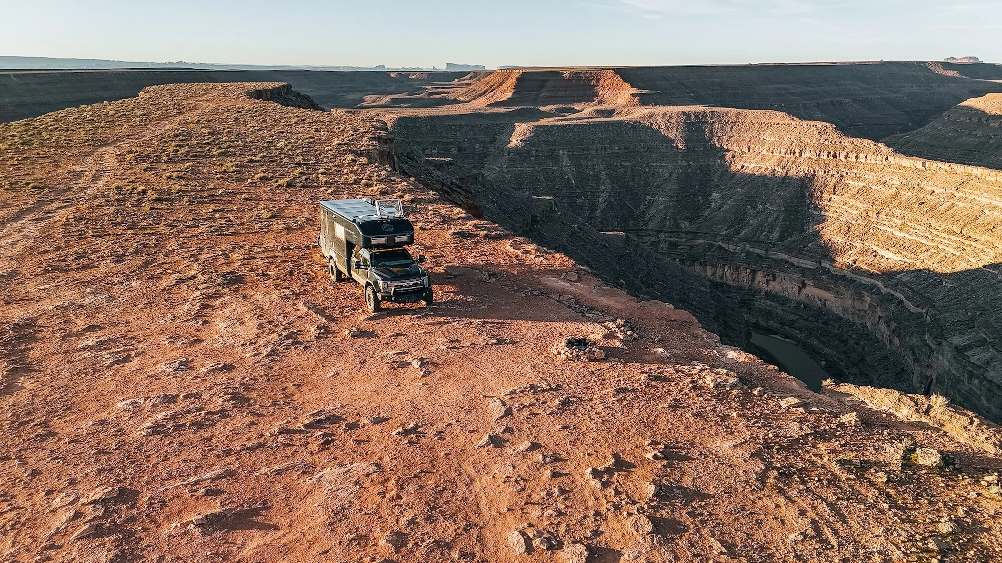
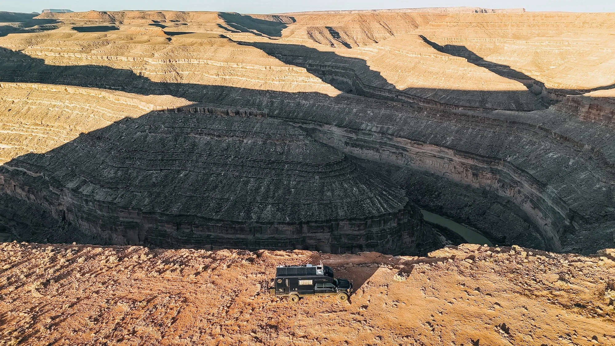
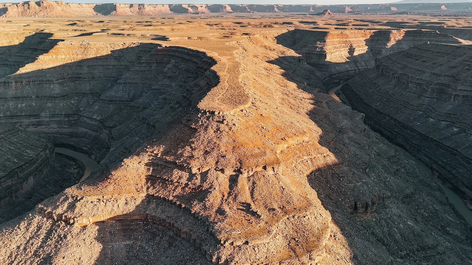
Stop 1: Goosenecks State Park
Our first stop was Goosenecks State Park, perched on the rim above one of the most dramatic entrenched meanders on the planet. The San Juan River coils below in a series of impossibly tight loops 1,000 feet straight down.
For Elissa, it was breathtaking. For Jacob, it was a full-body confrontation with his fear of heights.
Practical info for overlanders:
Day use fee: $5/vehicle (paid at the entrance kiosk)
No hookups — dry camping only
The rim viewpoint is paved and accessible, but the campsite itself is gravel with no shade
Elevation: ~4,700 ft
The views here are genuinely unlike anything else in Utah. If you can stomach the edge, get as close to the rim as possible — the scale of those river bends doesn't translate in photos.
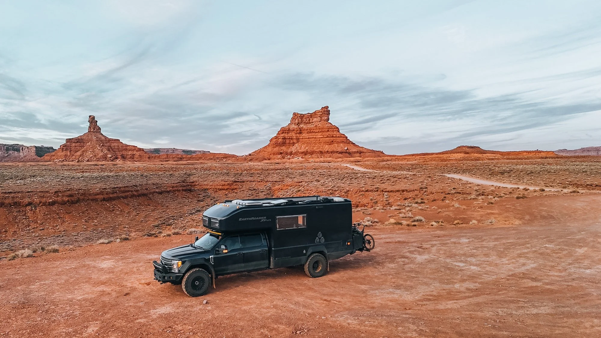
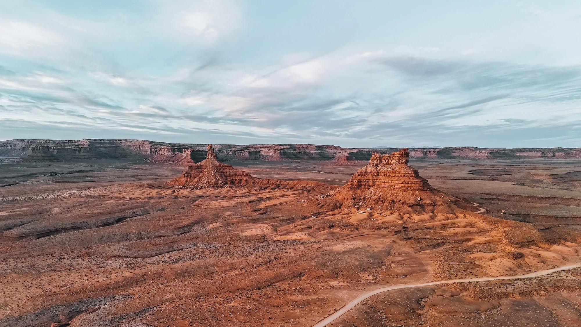
Stop 2: Valley of the Gods: The Free Alternative to Monument Valley
Skip Monument Valley and go to Valley of the Gods instead (especially if you're in a large rig).
Monument Valley is iconic, but Valley of the Gods is completely free, sits on BLM land, and delivers virtually the same dramatic sandstone butte scenery without the crowds or the cost.
The 17-Mile Loop:
Unpaved — passable in good weather for most rigs, but check conditions after rain
No services, no fee
Stunning drone opportunities (we had the place nearly to ourselves)
Cell service: essentially zero
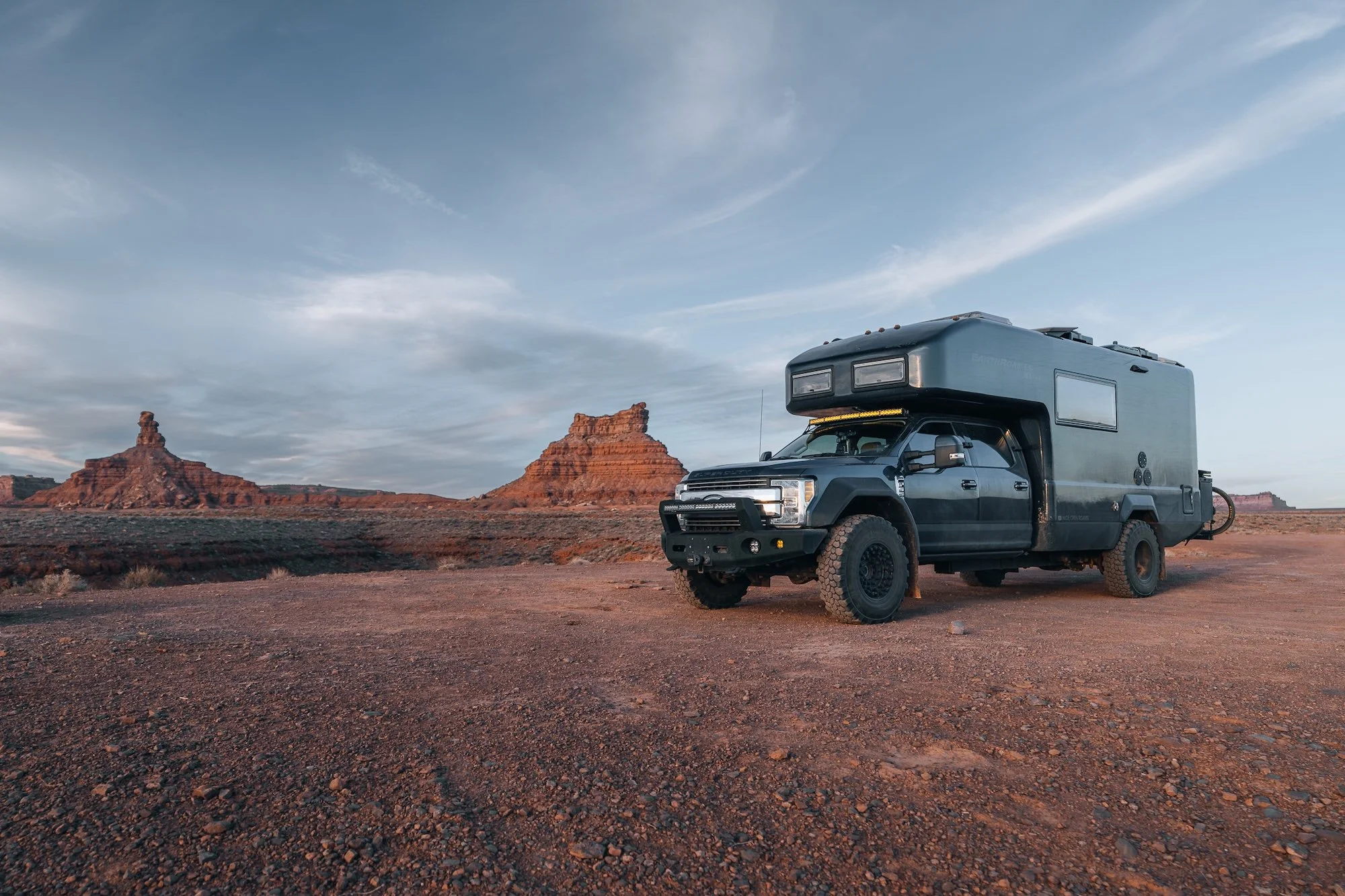
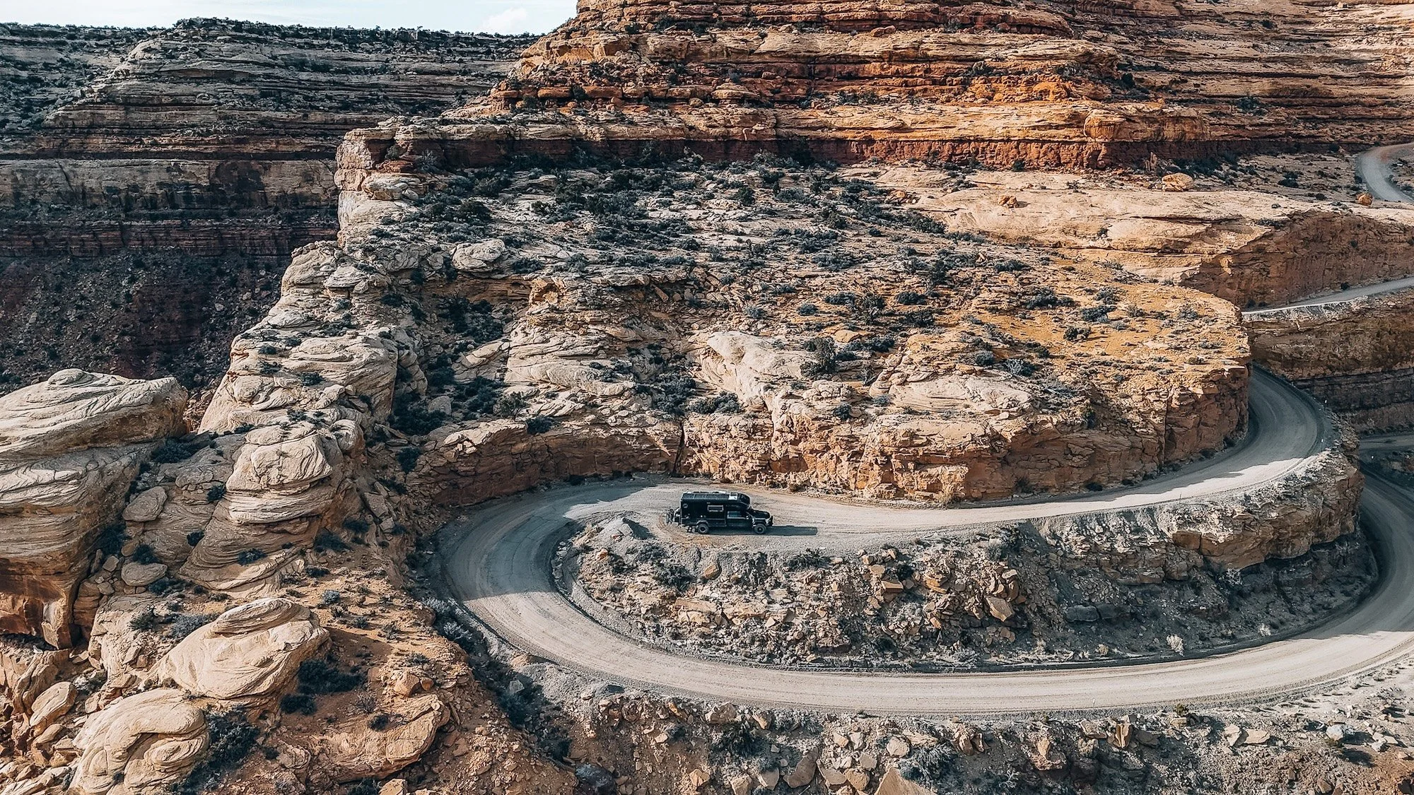
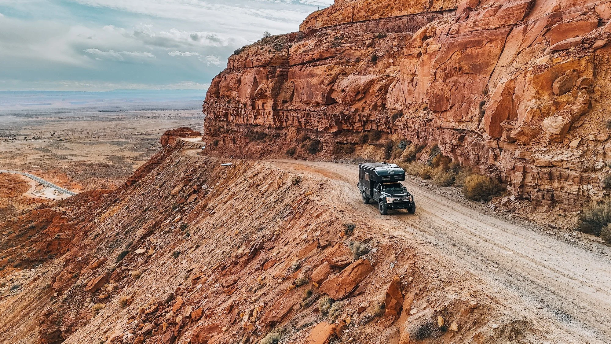
The Main Event: Moki Dugway
We won't sugarcoat it. This made it into the top 5 most nerve-wracking driving moments we've had in the EarthRoamer.
The road is a series of tight switchbacks cut directly into the clifface of Cedar Mesa. No pavement. Minimal barriers. Sheer drops inches from your passenger-side tires. We dropped into 4-low before the first turn and didn't come out of it until we crested the top.
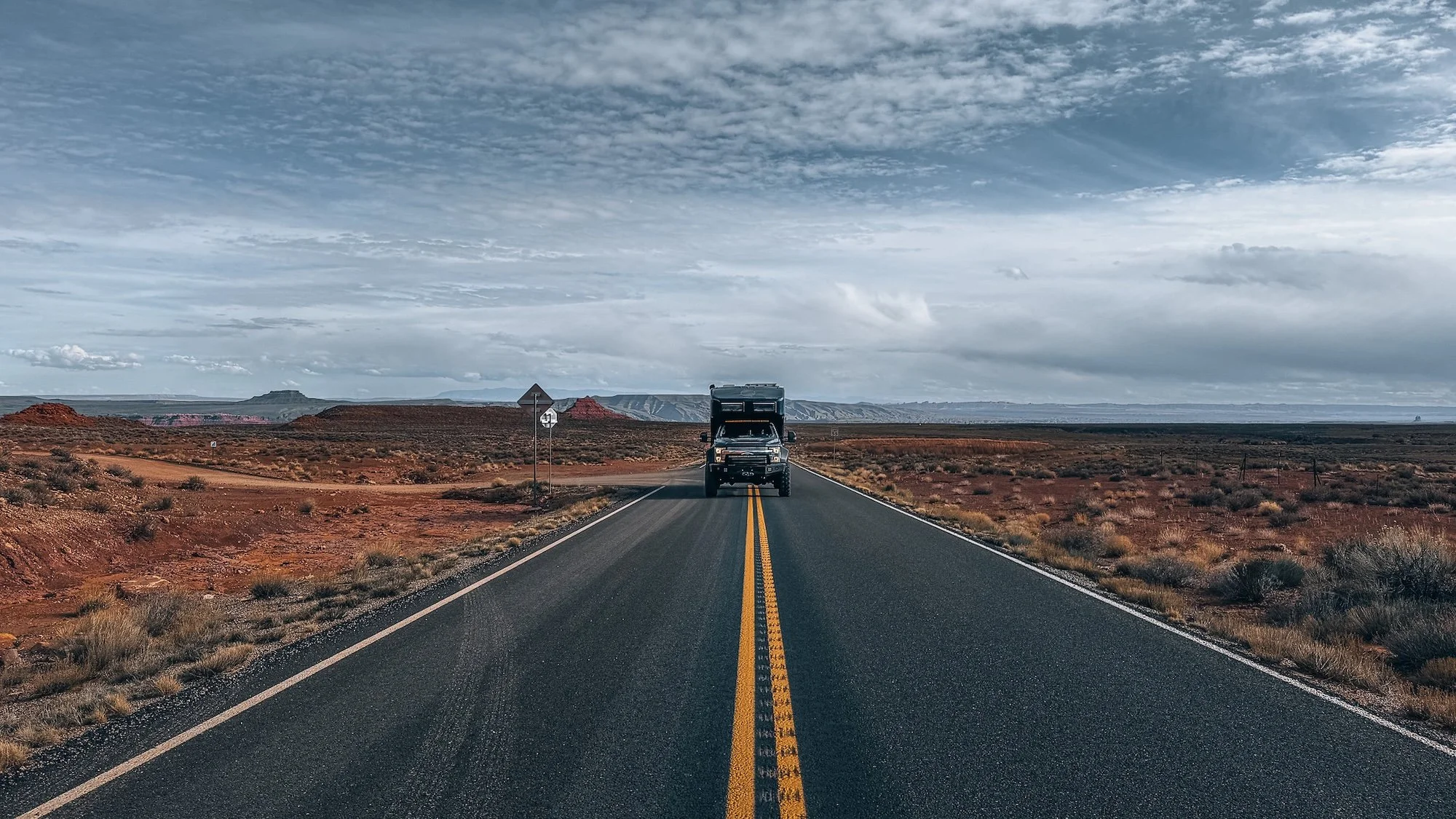
If you're considering driving the Moki Dugway in a large rig:
Do it on a weekday morning to minimize traffic
Drop into 4-low before you begin — not after you're already committed
The "not recommended over 10,000 lbs" sign is advisory, not a gate. Use your judgment.
Uphill traffic has the right of way
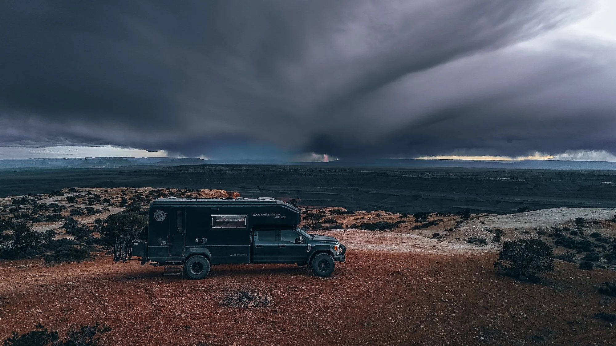
Muley Point: The Storm That Came Out of Nowhere
At the top of the Moki Dugway sits Muley Point, one of the most spectacular free camping spots in the American Southwest. The views extend across the entire Monument Valley region. On a clear night, the stargazing is world-class.
We didn't get a clear night.
Within hours of arriving, the weather changed fast. What started as a few distant clouds became a full-blown storm system. We broke camp in the dark and navigated out on soaked dirt roads with little visibility.
Weather note for trip planners: Southern Utah in spring (and even early summer) is notorious for fast-moving afternoon storms. Check forecasts obsessively, and always have an exit plan before you're weathered in at a remote camp.
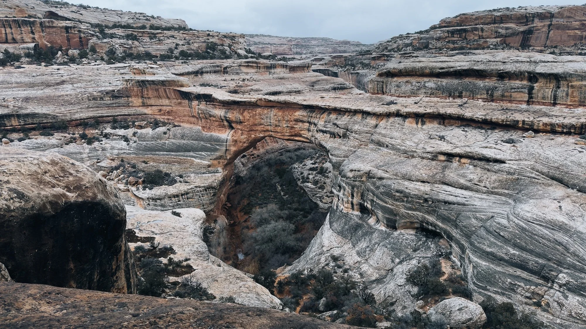
Natural Bridges National Monument: The Hike to Sipapu Bridge
Since we bailed on Muley Point, our final stop ended up being Natural Bridges National Monument—one of Utah's lesser-visited parks and, in our opinion, criminally underrated.
The centerpiece hike of the park is the trail to Sipapu Bridge, one of the largest natural bridges in the world.
Trail stats:
Distance: ~1.2 miles one-way
Elevation change: ~400 ft
Difficulty: Moderate (ladders required)
Best time: Morning (if visiting in the summer, consider the intensity of afternoon sun in the canyon)
The park itself has a 13-site campground with bear boxes and vault toilets, no hookups, and a first-come-first-served policy. America the Beautiful Pass gets you in free. The 9-mile scenic drive loops past all three bridges and has pullouts suitable for large vehicles.
Final Thoughts
This stretch of Southern Utah — Goosenecks → Valley of the Gods → Moki Dugway → Muley Point → Natural Bridges — is one of the most spectacular routes we've driven in the EarthRoamer. It's also one of the most demanding. Weather, road conditions, and vehicle size all factor into whether this loop is a dream or a nightmare.
Watch the full video of this trip!